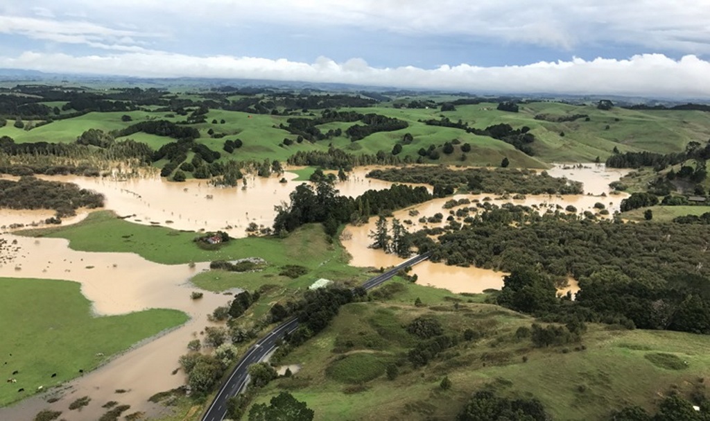
River levels are still high and will stay that way for the next 48-72 hours. This means that already flooded areas are unlikely to recede quickly. People are advised to take care. There is still significant debris and roads are slippery. When driving on the roads please exercise extreme caution.
Teams are working hard to clear and re-open roads in the district. Several roads have been re-opened. They are:
• Rotowaro Road and Hangapipi Road, Huntly
• Waingaro Road, Ngaruawahia
• Tuakau Bridge-Port Waikato Road
(Note: Driver caution is advised as there is still debris and slippery surfaces along this route. Traffic management is in place in and around the slip area. Work will continue today on clearing the road.)
• Waitetuna Valley Road, Te Uku
• Old Mountain Road, Raglan.
The following roads are closed or partially closed due to flooding and/or slips:
• Riverview Road, Huntly: open to one lane
• River Road, Tuakau: Unfortunately River Road in Tuakau remains closed and opening it to one lane is not an option at this stage due to the risk of further material falling. Work will continue on the road today. The team is currently organising for a drone flight in order to assess the slope stability further up.
• Richardson Road, near Waikaretu: Will be worked on today. Hoping to have it accessible by the end of the day.
• Highway 22 north of Glen Murray: one lane
• Klondyke Road, Onewhero
• Allen and Eyre Road, Tuakau: one lane
• Ponganui Road, Onewhero: one lane
• Pioneer Road, Pokeno
• Te Hoe, Orini Road and Tenfoot Road, Orini/Taupiri
• Brien Road, Onewhero: slip being cleared today.
• Venna Fry Lane, Huntly: top end
• Blackett Road, Whatawhata
• Koheroa Road, Mercer
Teams are continuing to monitor the situation around the district, including checking in on people.
Boaties are asked to stay clear of power lines crossing local rivers. Particular care is required on the Waipa River approximately 150 metres south of Maori Point Road (Whatawhata) where, due to flooding and rising river levels the clearance conditions have been compromised. Any concerns or questions please contact WEL Networks on 0800 800 935.
For safety reasons, people are advised that all walking tracks in our district, including the Hakarimata track, should be avoided until further notice.
If you are concerned about flooding or your welfare or the welfare of others, please phone 0800 492 452 or if in you are in immediate danger call 111.
Should water levels rise and threaten homes residents are urged to evacuate to higher ground and to notify us as soon as possible. People are reminded to drive safely through flood waters and to avoid affected areas if possible.
Stay informed:
• www.metservice.co.nz
• www.civildefence.govt.nz
• www.facebook.com/waikatodistrictcouncil
• www.twitter.com/waikatodistrict
• www.waikatodistrict.govt.nz
Media contact:
Sheryl Flay
Phone: 027 55 11 601
Email: communications@waidc.govt.nz
River levels still high; work to clear roads continues

